Difference between revisions of "Bonney Meadows to Boulder Lakes Loop Hike"
From Oregon Hikers Field Guide
(change junction name) |
m |
||
| Line 30: | Line 30: | ||
The Boulder Lakes are in a forgotten corner of the Mount Hood region, yet remain close enough to Portland to be a day hike destination. There are good campsites at both Boulder Lake and Little Boulder Lake, so this loop hike could work as an overnight backpack. Note that the hike begins with an elevation loss if you follow the recommended route, but there is an alternate trailhead described in the [[Boulder Lakes Hike]] that puts the climbing on the front end of the hike, and has a less bumpy access route. Also, please note that 0.8 miles of the loop follows a little-used logging spur -- you will be unlikely to encounter vehicles, but should keep an eye out for them, nonetheless. | The Boulder Lakes are in a forgotten corner of the Mount Hood region, yet remain close enough to Portland to be a day hike destination. There are good campsites at both Boulder Lake and Little Boulder Lake, so this loop hike could work as an overnight backpack. Note that the hike begins with an elevation loss if you follow the recommended route, but there is an alternate trailhead described in the [[Boulder Lakes Hike]] that puts the climbing on the front end of the hike, and has a less bumpy access route. Also, please note that 0.8 miles of the loop follows a little-used logging spur -- you will be unlikely to encounter vehicles, but should keep an eye out for them, nonetheless. | ||
| − | The hike begins after a bumpy drive on primitive roads to the rustic forest camp at | + | The hike begins after a bumpy drive on primitive roads to the rustic forest camp at Bonney Prairie. From the signed trailhead at the north end of the campground, the Boulder Lake Trail (No. 463) heads across the northern fringe of the meadows and crosses Bonney Creek -- the only reliable source of water along the trail -- before reaching the well-signed [[Boulder Lake-Hidden Meadows Trail Junction]] that you will be returning to. Continue straight (left) at this junction, climbing gently for a short distance, then turn north as you begin a well-graded traverse into the Bonney Creek Valley. The trail switchbacks south, then passes below a series of rugged talus slopes that drape below [[Echo Point]]. Badger Butte appears to the east, across the Boulder Creek Valley. |
Pass tiny Kane Springs (not a reliable water source) just beyond the last of the talus slopes, then pass over a low saddle, where the trail turns sharply left, descending to the east shore of [[Boulder Lake]] at the 1.8 mile mark. The lake has several fine campsites along the east and south shores, and even a picnic table, but is only 3/4 mile from the [[Boulder Lake Trailhead]], so you should expect campers here on summer weekends. A loop trail circles the lake. | Pass tiny Kane Springs (not a reliable water source) just beyond the last of the talus slopes, then pass over a low saddle, where the trail turns sharply left, descending to the east shore of [[Boulder Lake]] at the 1.8 mile mark. The lake has several fine campsites along the east and south shores, and even a picnic table, but is only 3/4 mile from the [[Boulder Lake Trailhead]], so you should expect campers here on summer weekends. A loop trail circles the lake. | ||
Revision as of 01:23, 1 October 2014
- Start point: Bonney Meadows Trailhead
- End Point: Bonney Meadows Trailhead
- Trail Log: Trail Log
- Hike Type: Loop
- Distance: 6.1 miles round-trip
- Elevation gain: 910 feet
- High Point: 5,409 feet
- Difficulty: Moderate
- Seasons: Late June through October
- Family Friendly: Yes
- Backpackable: Yes - camping at Bonney Meadows, Boulder Lakes
- Crowded: Never
Contents |
Description
The Boulder Lakes are in a forgotten corner of the Mount Hood region, yet remain close enough to Portland to be a day hike destination. There are good campsites at both Boulder Lake and Little Boulder Lake, so this loop hike could work as an overnight backpack. Note that the hike begins with an elevation loss if you follow the recommended route, but there is an alternate trailhead described in the Boulder Lakes Hike that puts the climbing on the front end of the hike, and has a less bumpy access route. Also, please note that 0.8 miles of the loop follows a little-used logging spur -- you will be unlikely to encounter vehicles, but should keep an eye out for them, nonetheless.
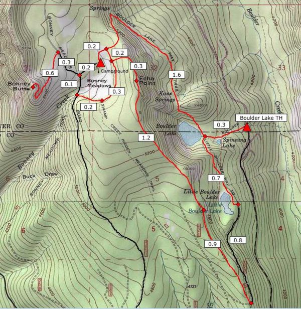
The hike begins after a bumpy drive on primitive roads to the rustic forest camp at Bonney Prairie. From the signed trailhead at the north end of the campground, the Boulder Lake Trail (No. 463) heads across the northern fringe of the meadows and crosses Bonney Creek -- the only reliable source of water along the trail -- before reaching the well-signed Boulder Lake-Hidden Meadows Trail Junction that you will be returning to. Continue straight (left) at this junction, climbing gently for a short distance, then turn north as you begin a well-graded traverse into the Bonney Creek Valley. The trail switchbacks south, then passes below a series of rugged talus slopes that drape below Echo Point. Badger Butte appears to the east, across the Boulder Creek Valley.
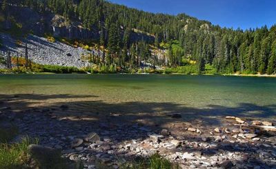
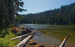
Pass tiny Kane Springs (not a reliable water source) just beyond the last of the talus slopes, then pass over a low saddle, where the trail turns sharply left, descending to the east shore of Boulder Lake at the 1.8 mile mark. The lake has several fine campsites along the east and south shores, and even a picnic table, but is only 3/4 mile from the Boulder Lake Trailhead, so you should expect campers here on summer weekends. A loop trail circles the lake.
From the signed Boulder Lake-Little Boulder Lake Trail Junction near the lake outlet, follow the Little Boulder Lake Trail (No. 463A) and begin climbing the shoulder of a steep ridge that forms the south wall of Boulder Lake. The trail soon curves around the ridge and makes a gentle descent to the basin that holds Little Boulder Lake. You will reach the northeast lake shore at the 2.5 mile mark, and there are campsites located along the east side of the lake. While not apparent, a little-used logging spur circles to the east of the lake, along the rim of the Boulder Creek Valley. Look for a short, unmarked trail from the northeast corner of the lake that leads to the road, then turn right and follow the road uphill for 0.8 miles past many sweeping views across the valley to Grasshopper Point before cresting a ridge and reaching Trail 473 at the 3.3 mile point.
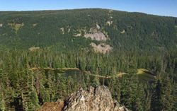
Turn onto the signed Forest Creek Trail (No. 473), and head briefly into forest before emerging in the first of six recovering clear cuts traversed by the trail. Just under a mile from the road junction, and after crossing the edge of the third clear cut, watch for a rugged viewpoint overlooking Little Boulder Lake, far below, and Grasshopper Point on the far side of the Boulder Creek Valley. Return to the trail and continue climbing north toward Echo Point, passing three more clear cuts before entering deep noble fir forests for the rest of the hike.
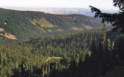
At 5.4 miles, the trail suddenly crests Echo Point, forested on the west, but open to the east. Look for a short side loop that passes across the steep meadows on the east face where the main trail stays in the trees on the west side of the crest. From here, the Boulder Creek Valley unfolds below, and Mount Hood can be seen peeking through the trees to the northwest. Lookout Mountain and Flag Point in the Badger Creek Wilderness are visible on the horizon (see the Echo Point panorama view at the bottom of the page).
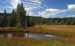
From Echo Point, the trail drops quickly to the signed loop trail around Bonney Meadows. If you have time, consider turning left (south) and exploring the southern portion of the loop, where Mount Hood can be seen from a couple ponds along the meadow fringe. Otherwise, turn right at the Hidden Meadows-Forest Creek Trail Junction, and follow the remainder of the Forest Creek Trail north for 0.2 miles to the first signed junction you passed earlier in the hike (the Boulder Lake-Hidden Meadows Trail Junction). Turn left, and retrace your steps on the Boulder Lake Trail the short distance to the Bonney Meadows Campground.
Maps
Trip Reports
- Search Trip Reports for Bonney Meadows to Boulder Lakes Loop Hike
Related Discussions / Q&A
- Search Trail Q&A for Bonney Meadows to Boulder Lakes Loop Hike
More Links
Page Contributors
- Splintercat (Tom Kloster) (primary)


