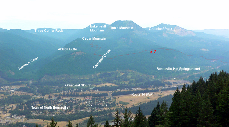
Greenleaf Peak
From Oregon Hikers Field Guide
- Hikes to this destination:
- Greenleaf Peak Hike (TH | <— —> | LOG)
- Weather forecast: NWS/NOAA
- Maps: Oregon Hikers Maps Google Maps
- Latitude, Longitude: 45.71383, -121.96695
- Elevation: 3422 feet
Description
Greenleaf Peak, sheared in half by a landslide, exposes its interior in the line of cliffs above Stevenson known as the Red Bluffs. To the west is Table Mountain, also a victim of a massive landslide, while to the east is the Rock Creek valley. North of Greenleaf Peak is the Greenleaf Basin, once heavily logged and still dissected by a power line corridor. While there are no official trails here, the old logging roads offer numerous possibilities for the hiker.
The Greenleaf Peak/Red Bluffs landslide is of a different age than the Bonneville Landslide, which collapsed the south face of Table Mountain. The latter may have occurred as recently as 1700, during the last great Cascadia earthquake; Greenleaf's south face was sheared off by an earlier event. Since the Washington side of the Gorge is tilting south and, in this area, hard layers of Columbia River basalts overlie the softer Eagle Creek Formation, landslides occur on a regular basis. The last large slide, in December 2007, created an impressive scar on the slope between the peak and Greenleaf Falls.
Greenleaf Peak also hosted one of the most notable first ascents (by a non-indigenous person) in what is now the western United States: David Douglas, the celebrated Scottish botanist and explorer, hiked to the top in 1825!
More Links
- Greenleaf Peak (Summit Post)
- "Greenleaf Peak, Greenleaf Basin, and Red Bluffs, Washington" (The Columbia River: A Photographic Journey)
- Greenleaf Peak (Wikipedia)


