Crane Prairie-Boulder Lakes Loop Hike
From Oregon Hikers Field Guide
| This page is marked as a Lost Hike. The "trail" may be dangerous and hard to follow and is not recommended for beginning hikers without an experienced leader. Carry detailed maps of the whole area and/or a GPS unit and compass. |
- Start point: Crane Prairie Trailhead
or
- Start point: Bonney Meadows Trailhead
or
- Start point: Boulder Lake Trailhead
- End Point: Boulder Lake
- Hike Type: Loop
- Distance: 8.7 miles
- Elevation gain: 1,280 feet
- High Point: 5,485 feet
- Difficulty: Moderate
- Seasons: Summer through Fall
- Family Friendly: No
- Backpackable: No
- Crowded: No, except around Boulder Lake
Contents |
Description
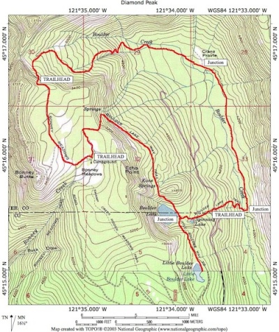
This hike takes in the head of the Boulder Creek valley, which is now in the southern unit of the new (2009) Mt. Hood National Recreation Area. The habitat in most of the hike area consists of unsullied bogs, ponds, meadows, springs, and diverse old growth. The loop includes the unmaintained Crane Prairie Trail, Crane Creek (a.k.a. Boulder Creek) Trail, Boulder Lake Trail, Little Boulder Lake Trail, and a section of the notorious FR 4891. There are various ways to access this loop. The easiest on your car is to begin at the Boulder Lake Trailhead; if you have decent clearance on your vehicle, you may also begin the hike at the hard to find Crane Prairie Trailhead, or the Bonney Meadows Trailhead at Bonney Meadows Forest Camp, or even the Bonney Butte Trailhead, these three being located along FR 4891. This description begins from the Bonney Meadows Trailhead.
WARNING: Part of this route is on the unmaintained Crane Prairie Trail. Venture down (or up) this trail only if you're an experienced abandoned trail hiker. Expect lots of downed logs and plenty of brush in sections. The bogs in the Boulder Creek bottomlands above Crane Prairie will be a sucking, mucky mess augmented by hungry clouds of mosquitoes in the wet season.
Head out to FR 4891 from the Bonney Meadows Forest Camp. At 4891, go right and walk uphill among lodgepole pines, mountain hemlocks, noble and silver firs, and Engelmann spruce with an understory of huckleberry and grouseberry. Pass the gated road up to Bonney Butte and the Bonney Butte Trailhead parking pullouts. The road keeps rising to a campsite before it drops down around a wide curve in shady woods. Where the road curves left, there’s a two-car pullout on the right, the Crane Prairie Trailhead. Ten yards beyond this, the trail heads down into dry woods on a definite tread.
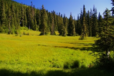
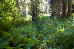
Pick up the track traversing down to the left. A sign confirms this is Crane Prairie Trail #464. The trail heads down through huckleberries and white rhododendrons and past a meadow with three tarns filled with tadpoles in mid-summer. The path then veers to the left, passes a boggy area and then drops through dry woods and traverses right. You will see a large boggy meadow two hundred yards down the hillside to the left. These are the headwaters of Boulder Creek. The route passes through more white rhododendron thickets. Cross a creek and a bog above a blooming meadow. Flagging and red paint marks may help you find your way through the brush here. There are also blazes on trees to note. Then the trail heads down with Boulder Creek to the left. Take note of the elk tracks in this area. Head to the right above a marsh-marigold swamp before turning left and crossing two creeks. There are bigger trees, especially noble fir, Douglas-fir, and Engelmann spruce, as you near the valley floor. Western red-cedar, mountain hemlock, silver fir, and grand fir also populate this diverse transitional woodland. The trail heads down a ridge with a gully and a small waterfall to the right. Boulder Creek flows to the right as the trail levels. Finally, you will cross Boulder Creek and pass underneath some large spruces and through a blooming skunk-cabbage bottom. Reach a small, sunny clearing. Here the trail braids: right is through a boggy area hemmed by willows and to the creek; left is through the dry woods. In an open area, part of the string of Crane Prairie meadows, the trail follows a dry runoff channel. Pass through a second meadow and then walk through lupines and step across a brook. The trail rises past a screen of young conifers and then a thicket of Sitka alder at the Crane Prairie-Boulder Creek Trail Junction with the latter trail rising up the slope to the Camp Windy area. You may see the rotting junction sign lying on the ground.
Keep along the Boulder Creek Trail, enter a swamp and pass through two fence posts, where there was a gate used in the days when stock were run up into this isolated bowl. The trail continues through small dry meadows, bogs, and woods, and crosses several streams. There is much less blowdown and debris in this section. Cross more little brooks and drop through a clearing to reenter the woods. Then there’s a larger dry meadow that is frequented by elk. Continue past a large talus slope up to the left. In this area, there are western white pines and very large Douglas-firs and also a few western hemlocks. Note the stand of quaking aspen up on the talus slope. Pass under a huge fallen Douglas-fir, approximately 250’ in length. The trail now drops to the Boulder Creek-Boulder Lake Trail Junction. (The signposts say that this is the Crane Creek Trail. Boulder Creek was designated as such until the mid-1920s. It was changed to Crane Creek and remained that way until the mid-1970s, when it was changed back to Boulder Creek.)
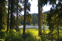
Go right here and reach Boulder Creek and its footbridge. The trail rises and then drops to cross a gully. The trail keeps rising before leveling in shady woods and reaching gravel FR 4880. Go left 25 yards to the often busy and dusty Boulder Lake Trailhead to find the tread heading up through a thicket of willows and into the woods. This trail can be a virtual wagon road for people carting up supplies and water toys on a hot summer weekend, making you appreciate the solitude of the abandoned trails down in the valley. However, you can also admire the large Douglas-firs and noble firs in the woods here. Pass by shallow Spinning Lake on the left. The trail heads along next to a creek and reaches popular Boulder Lake, where many may be enjoying a warm summer day.
For a less populated lake, go left at the Boulder Lake-Little Boulder Lake Trail Junction. The trail rises up along a steep slope cloaked with huckleberries, then drops and travels at the level to Little Boulder Lake. A spur trail left leads to a gated spur road. Little Boulder Lake is very peaceful and it is worth tarrying a while here before returning to Boulder Lake.
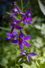
Back at Boulder Lake, head along the lakeshore to a junction with the loop trail around the lake. Go right here and travel uphill above a large campsite. The trail heads over a ridge crest and then drops in shady woods below a talus slope. Rise again and then walk on the level in dry woods with silver and noble firs and views to Badger Butte. Reach the base of a large talus slope in the vicinity of Kane Springs. Lush thickets of mertensia and tongue-leaved rainiera cloak this area. Butterflies abound when the sun is out. Pikas squeak their alarm calls, and yellow-bellied marmots live close to the trail. Pass below the Echo Point ridge and cross more talus. The trail rises from here into cool woods to pass a small spring before switchbacking and rising over a hump to drop into Bonney Meadows. At the Boulder Lake-Hidden Meadows Trail Junction, signed for the Forest Creek Loop #473, go right. Cross Bonney Creek and head through meadows and then into woodland, before dropping gently to the Bonney Meadows Forest Camp.
Fees, Regulations, etc.
- none
Maps
- Maps: Hike Finder
- Green Trails Maps: Mt. Hood, OR #462
- U.S. Department of Agriculture, Forest Service: Barlow Ranger District
- U.S. Department of Agriculture, Forest Service: Mt. Hood National Forest
- National Geographic Trails Illustrated Map: Mount Hood Wilderness
- National Geographic Trails Illustrated Map: Mount Hood
- Adventure Maps: Mt. Hood Area
- Adventure Maps: Hood River, Oregon, Trail Map
- Adventure Maps: 44 Trails Area plus the best of the G.P.N.F.
Trip Reports
- Search Trip Reports for Crane Prairie
Related Discussions / Q&A
- Search Trail Q&A for Crane Prairie
Guidebooks that cover this destination
- Off the Beaten Trail by Matt Reeder
- Best Old-growth Forest Hikes: Washington and Oregon Cascades by John and Diane Cissel
- Hiking Mount Hood National Forest by Marcia Sinclair
More Links
Page Contributors
- bobcat (creator)


